Geothermal Energy
in Afghanistan:
Prospects and Potential
SABA et al
1feb04
Saba, D. S.1, Najaf, M. E.2, Musazai, A. M.2, and
Taraki, S. A.3
1 Consultant, 12201 Mara Lynn Road, #8307, LR, AR 72211, USA. daudsaba@yahoo.com
2 Department of
Geology and Exploration of Mineral Resources Faculty of Geology and Mines, Kabul
Polytechnic Institute, Afghanistan.
3 Faculty of Economics, Herat
University, Herat, Afghanistan.
Prepared For:
http://www.nyu.edu/pages/cic/index1.htmlCenter on International
Cooperation, New York University, New York, USA.
&
Afghanistan Center for Policy and Development Studies, Kabul,
Afghanistan.
February 2004
ABSTRACT
Historically, geothermal energy in Afghanistan has been only used for medical
bathing. This application is still one of important utilization of geothermal
energy in Afghanistan. Initial exploration efforts for mineral and thermal water
resources of Afghanistan began in 1969. However, geological studies, geophysical
exploration and drilling programs have not been carried out for characterization
of reservoirs and capacity of the country's geothermal prospects. This study is
a framework to facilitate such studies.
The structure of Afghanistan is created by the collision of the Indian and
Eurasian plates along the Herat-Panjshir E-W striking geosuture, resulting in
the uplifting of the Hindu Kush on this axis since the end of the Cretaceous,
some 65 million years ago. Neotectonic movements in Afghanistan generated by
these collisional events are characterized by seismic and geothermal activities
all over the country. Upon this geological condition, many geothermally active
areas are currently known with surface manifestations in the form of hot
springs, which demonstrate the wide perspective of development and utilization
of geothermal prospects in this country.
Further geological, geochemical, and geophysical exploration is required to
characterize the reservoirs of numerous geothermal prospects in Afghanistan for
possible electric power generation and other technologically advanced uses of
this renewable energy resource. Use of geothermal energy in Afghanistan is
realistic. However, it is suggested that at this stage, direct use of geothermal
energy is the most feasible way to put this abundant renewable energy resource
into use. In this framework, there is tremendous potential for applications such
as in the food processing, fruit drying, carpet and wool processing, chemical
industry, greenhouse industry, fish hatchery and farming, refrigeration, and
many other small-scale local industries.
Foreword
Afghanistan is an energy-deprived country. Anecdotal evidence suggests that
per capita energy use in this country is substantially lower by international
standards. As the reconstruction process advances further, the demand for energy
will increase. As the World Energy Commission puts it, energy affects all
aspects of modern life and human development (WEC, 1993). For Afghans to
successfully rebuild their country, new initiatives has to be undertaken to
satisfy the increasing energy needs of the country. In this circumstance, there
is urgent need to deploy sustainable and environmentally clean energy sources,
such as geothermal energy, which is abundantly available in Afghanistan.
On a worldwide scale, geothermal energy already makes an important
contribution. More than 50% of installed electric power capacity from "new"
renewables such as geothermal, wind, tidal, and solar is realized in geothermal
power plants. In recent years, significant advances have been achieved with
engineered geothermal systems. Innovative power plants permit the production of
electricity using low thermal water temperatures of the order of 100 °C. A major
advantage of geothermal energy among other renewables is the availability of the
resource all day, all year round.
Today, many countries stand out as having made utilization of geothermal
resources a national priority. For example, in Tibet, which is very similar in
its culture, geography and geological structure to Afghanistan, until 1997, the
annual power generation only from Yangbajing power plant was at 110 GWh/yr,
which accounts for 41% of total power in the Lhasa in the summers, and up to 52%
during the winter times. The development of other potential reservoirs in Tibet
is growing at a very fast pace (Du Shaoping, 2000). Approximately 26 percent of
electrical power generation in the Philippines, which is another developing
country, though very different from Afghanistan, comes from geothermal steam.
Afghanistan like many other countries possesses underutilized geothermal
resources. The examples of developed geothermal resources in different
industrial and developing countries could be replicated, as the World Geothermal
Congress declared, if there was the will to do so (WGC, 2000).
1. Introduction
As Afghanistan continues the process of reconstruction, the national demand
for commercial energy services is expected to grow, especially with respect to
the majority of population of the country without access to modern energy
services. The current electric power capacity in Afghanistan based on available
data could be estimated to be somewhere in the range of 400 MW (megawatt of
energy). Hydroelectric dams, most notably at Kajaki, accounts for 260 megawatts,
which represents only about 5 percent of the total hydroelectric potential of
the country. Thermal plants, fired by oil and coal, provide another 134
megawatts of this capacity (Nyrop and Seekins, 1986). By completion of the
Turkmenistan and Iranian transmission lines to western Afghanistan during the
2004, another 80 MW of electrical power would be added to the present capacity.
At the same time, anecdotal evidence suggests serious power shortages all over
the country. In Kabul, for example, there are frequent blackouts, and in the
city's poorer neighborhoods, homes averaged to have only fifteen to twenty hours
of power per week. This is at a time that few industries are functioning.
But the status quo is changing. We know that in the United States, a megawatt
of electrical power provides 700 typical Americans with their power needs. Of
course, this is not a realistic and appropriate level to be adopted as a target
for Afghanistan, but, if we assume the level of power consumption by developing
countries such as Turkey, Mexico, or Egypt, which is ten times lower than that
of the United States (IEA, 1998), as an optimal hypothetical target for
Afghanistan, then the country requires at least 3.5 GW (gigawatt of energy) of
electrical power, based on the number of the population that has been estimated
to be [24,377,530] persons (CSO, 2003). It is obvious that the power capacity
and demand gap in Afghanistan is a very wide one. Meeting this growing demand
for energy, while at the same time, addressing the adverse environmental effects
of using non-renewable fossil fuels, will necessitates an increase in the use of
reliable and diversified renewable energy sources, preferably indigenous, be it
hydroelectric, geothermal, biomass, solar or wind.
There is a tremendous amount of heat energy locked inside the planet earth in
magma, and dry hot rocks, sometimes, as shallow as a mile or two below the
surface. In a sense, the earth's interior can be thought of as a natural nuclear
power reactor, because, the heat is mainly derived by the decay of radioactive
elements. Under normal conditions, the earth's natural heat increases by as much
as (10-38º C) with every mile of depth. This heat flow towards the earth's
surface is an indication of the colossal amounts of heat energy at the earth's
interior. There are times when some of this comes to the surface in the form of
lava, steam, or hot water. This is geothermal energy "geo" meaning earth, and
"thermal" meaning heat. Thus, the earth is a reliable source of energy with its
potential available at any time.
Presently some sixty countries around the world are either plugging into the
earth, tapping its heat, and drawing some of it off in the forms of steam and
hot water to run geothermal power plants and produce electricity, or are in the
process of developing their geothermal resources. Other countries use this
source for residential and district heating systems, heating greenhouses for
growing vegetables, fruits, and flowers, or simply use it for balneological
applications. It is suggested that wherever geothermal energy is used, in the
long run, it turns out to be cheaper than oil or coal, natural gas or nuclear
power (Goldin, 1981; WEA, 2000).
For today's energy starved Afghanistan, there is plenty of this renewable
energy resource available to be exploited. Geothermal energy is the earth's
interior heat made available to man by extracting it from natural hot water or
underground rocks by appropriate technology, which is readily accessible.
High-temperature geothermal resources suitable for power generation are
generally located in areas subjected to volcanic or seismic activity.
Afghanistan is located in such an area, where geothermal resources can make a
worthwhile contribution to providing a reliable, renewable energy service for
the country.
In Afghanistan, active geothermal systems are generally located in the main
axis areas of the Hindu Kush, which runs along the Herat fault system, all the
way from Herat in the westernmost part of the country, up to the Wakhan corridor
in the Afghan Pamirs. This structure marks the compressed boundary of the
Eurasian plate and the Gondwanan fragments that have collided onto this boundary
in the territory of Afghanistan prior to the final collision of the Indian plate
onto Asia. Geothermal systems of Afghanistan are mainly associated with the
fault and fracture networks, seismic activity and young magmatism encountered at
this boundary and its associated branching fault systems.
Prospects of low to medium temperature geothermal resources are widespread
all over Afghanistan. There is tremendous potential for direct-use applications
of these resources, such as in the food processing, fruit drying, refrigeration,
fish hatchery and farming, carpet and wool processing, recreation and tourism,
and many other possible small-scale local industries. Directly using geothermal
energy in district heating and commercial operations is much less expensive than
using traditional fuels. From the environmental perspectives, geothermal energy
is also very clean, producing only a small percentage of the air pollutants
emitted by burning fossil fuels.
In the light of such an understanding, geothermal energy is a highly
valuable, clean and reliable heat and power source in Afghanistan, still
untapped. Through this study, an effort has been made to assess and evaluate the
potential of this resource for the development of Afghanistan's energy sector,
as well as tourist and food processing industries. Though many indications of
geothermal energy in the form of visible heat leakage in Afghanistan are known,
but their significance in the energy policy of Afghanistan is never been
appreciated, and to date totally ignored. The authors of this study hope to shed
light on this forgotten resource of the country and facilitate the development
of geothermal resources of Afghanistan.
2. Historical Background
Worldwide, geothermal energy for electricity generation and direct use has
been commercially utilized since 1913. Globally, use of geothermal energy
amounts to 49 TWh/y (terawatt hour per year of energy) of electricity and 53
TWh/y for direct use. Electricity is produced with geothermal steam in 21
countries. Of these, five countries obtain 10-22% of their electricity from
geothermal energy (Fridleifsson, 2000). However, so far, only a small fraction
of the global geothermal potential is developed.
The use of geothermal resources in Afghanistan might have begun with the
settlement of the first people in the vicinity of the many hot springs in the
valleys of Hindu Kush, where these springs, served as a source of warmth, and
cleansing, and their mineral water as a source of healing. In this way,
probably, long time ago, these people learned to use the healing properties of
the hot water that came naturally out of the ground to make their life easier.
Through experience, they might have discovered that a good soak in those hot
springs cured certain ailments, e.g., stiff muscles and sore backs became
limbed, skin diseases cleared up, and wounds healed. For this particular reason,
many of these hot springs in Afghanistan are called "chashma-e shafa",
meaning the healing spring, a property that deemed them sacred. Thus, the
communities all over the country rightfully consider the protection of these
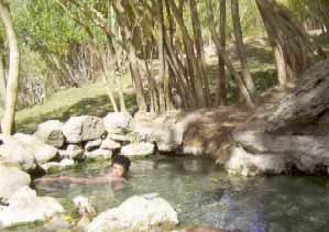
springs as their duty (Figure 1).
Figure 1. A satisfied young Afghan enjoys the traditional use of this
known "shefa" hot spring that healed his skin condition (Aabe-Garm,
Ghorband valley, province of Parwan, Afghanistan).
It is found that traditionally people are knowledgeable that drinking the
water which comes from springs with carbonic acid are good for stomach troubles,
bathing in sulfur-bearing springs improves their blood circulation, alum springs
are helping in healing their skin problems, springs with rare earth elements
(REE) contents relieve or even cure certain forms of arthritis, and strong acid
springs are good for venereal diseases. During fieldwork in Obe hot springs, the
authors met a family from Badghis province, who have traveled hundreds of
kilometers along the torturous dirt roads of northwestern Afghanistan to come to
this remote valley, just to tap into the healing properties of their known
healing hot spring.
Modern use of mineral thermal springs in Afghanistan goes back to 1940s, when
few thermal springs in Herat (Obe and Safed Koh), Balkh (Aabe Garm), and Orezgan
were developed for therapeutic purposes. However, soon these developments were
abandoned. In 1974, the Obe springs in Herat were renovated for bathhouse usage
(Akhi, 2001). Probably, at the same times, single bathrooms were built on hot
springs along the Kabul-Mazare Sharif highway in Pole-khumri and Hairatan towns.
The rest of the hot springs of Afghanistan are left undeveloped to date, but the
people continue to use them in their traditional ways (Figure 1).
The potential of modern exploitation of geothermal resources of Afghanistan
has not been studied. In 1964, an attempt has been made by Soviet geologists
working with the Geological Survey of Afghanistan (GSA) to conduct systematic
studies on thermal waters of the country for their potential mineral contents to
be used as exploration tools in search of minerals. In this way, the carbonated
hot springs in the valleys of Kalu, Ghorband, Shina, Dara-e Soof, and Istalef
were explored.
These exploratory studies had culminated with a survey of mineral and thermal
waters of Afghanistan during 1969-1970 (Belianin, et al., 1970). However, these
works were mainly focused on mineral contents and geological conditions of the
mineral water systems. No attempts have been made to characterize the dynamics
of geothermal systems of the Hindu Kush, or assess their energy reserves. Thus,
the potential of geothermal energy associated with these springs were totally
ignored and not been included in the exploration activities of GSA or any other
institution. This work is an attempt to kick-start efforts to fill this gap and
provide a framework for development of a geothermal databank for
Afghanistan.
3. Geothermal Potential in the Structural Domain of the Hindu Kush in
Afghanistan
3.1. Geological Structure:
In the earth, a certain amount of heat is generated by friction, as well as
by other sources, at the boundaries of the crustal plates. The structure of
Afghanistan is the result of accretion of such colliding Gondwanan microplates
or fragments onto the margins of Eurasia (Tapponnier, et al., 1981) along the
Herat-Panjshir E-W striking geosuture, which is a deep seated strike-slip fault,
dipping as deep as up to 700 kilometer into the mantle. This major structural
fault and fracture system in Afghanistan facilitates the percolation of water
into the superheated zones in the crust to produce geothermal fluids.
Similar structures along the Chaman-Moqor NE-SW striking fault system, the
Sarobi-Altimore NE-SW arcuate fault system, and other secondary faults
throughout Afghanistan cover most of the regions of this country (Figure 2),
where hot springs are the surface indication of geothermal energy resources
associated with them.
Neotectonic movements in Afghanistan generated by collisional events since
the end of the Cretaceous some 65 million years ago, resulted in the uplifting
of the Hindu Kush mountain ranges that extend from the north-easternmost corner
of the country in Badakhshan province in a NE-SW-W direction up to the
westernmost border of the country in Herat province, dividing the whole
structure of Afghanistan into northern and southern structural components (Saba
and Avasia, 1995a). Recent tectonic movements are characterized by seismic and
geothermal activities all over the country. The dynamic characters of the
resulting structures indicate north-south compression and east-west extension.
In addition, neotectonic movements show strong vertical uplifting, total rising
and differential tilting. Seismic activities in Afghanistan show a decreasing
tendency from east to west, with the strongest seismic activity occurring in the
northeaster Badakhshan province, where the most active structures of the country
are located (Figure 2).
Although the collision processes in the territory of Afghanistan have been
ended at the beginning of Palaeogene, approximately some 50 MY ago, based on
scenario of the Indian plate's final closure to Eurasia (Beck, et al., 1995),
but the geo-structural components of Afghanistan are still under enormous stress
from the south, exerted upon them by the ongoing movement of the Indian plate
northwards (Saba and Avasia, 1995b). This process produces enormous frictional
seismic and heat energy in the crust of this region, particularly along the
geosutures, faults and fracture zones.
Figure 2. Surface Indications of Geothermal Prospects of Afghanistan. (Map
shows thermal waters with a surface T of more than 20ºC)
Geothermal activities are closely associated with active terrains, and
therefore, the activity strength of a given hydrothermal system is directly
proportional to the activity strength of its associated active terrain. Due to
the collision of many Gondwanan microplates moving northwards onto the southern
margin of Eurasian plate, the strongest Neotectonic movements and intensive
associated hydrothermal activities are evidenced south of the Hindu Kush main
axis or the Herat-Panjshir geosuture. Thus, major geothermal manifestations are
located along the Herat-Panjshir geosuture and the Chaman-Moqor fault systems in
central Afghanistan active terrain (Figure 3).
Geothermal manifestations in these areas are mostly marked in the fracture
systems of active faults, within graben or halfgraben basins and linear faulted
valleys or wide valleys of the southern structural component of Afghanistan.
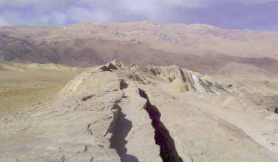
Figure 3. Neotectonic activity in the Hindu Kush resulting in dramatic
uplift and displacement of the crust, as viewed in this photo of the
Bande-Azhdar, Bamiyan, in central Afghanistan.
3.2. Active Magmatism and Volcanic Terrains:
Almost, all geological formations, i.e., from Precambrian to Quaternary
systems are contributing to the geological structure of Afghanistan. Generally,
these formations are of marine sediments with carbonaceous and continental
characters. Lesser amounts of submarine volcanic formations are also present.
Continental volcanism of Palaeogene, Neogene and Quaternary periods are
widespread in central, and southwestern Afghanistan (Shareq, et al., 1980),
where more than 50 dormant volcanic cones together form a volcanic zone with two
distinct belts, occupying a vast surface area in the deserts of these
regions.
Geothermal fields of Afghanistan are basically associated with magmatic
activity and collisional tectonic structures. A diverse array of magmatic
intrusive formations occupy approximately 8 percent of the total surface area of
the country (Musazai, 1994), which includes a variety of rocks with wide range
of temporal affinities, from the Precambrian era to Quaternary period.
Among these, geothermal indicators are found to be only associated with the
Palaeogene-Neogene magmatic formations that resulted from continental
collisional processes of Gondwanan fragments and the Eurasian plate margin in
the territory of Afghanistan. These are mainly distributed in the form of linear
magmatic structures in northeastern, central, southwestern and western
Afghanistan. In these geothermal fields, the energy source of geothermal
activity is controlled by magma chambers, which are located in shallow and
intermediate depths with various intrusion periods, depths and volumes.
An interesting observation in the field reveals that almost all thermal
indicators in Afghanistan are located in close contacts with young granitic
massifs, which are void of pegmatitic or aplitic vein formations. Thus, we could
not find surface manifestation of thermal waters in eastern Afghanistan, despite
extensive exposures of magmatic formations in this region. This implies that the
permeability in these rocks is controlled by fractures, which are already sealed
by pegmatite-aplite bearing mineralisations and the successive hydrothermal
alteration minerals, reducing the overall permeability of reservoir rocks.
Laterally continuous permeability forming domes or ridges that is difficult
to unequivocally relate to faults has also been reported in a number of
geothermal fields that are related to intrusive margins, which are usually very
permeable and form large and more easily predicted continuous targets (Bogie and
Lawless, 2000). The prospect of geothermal energy is much higher in association
with intrusive contacts of such magmatic terrains, which occupy the core of the
Hindu Kush mountain system, extending from northeastern extensions of the ranges
towards central, southern, and southwestern Afghanistan.
These include magmatic complexes such as the Wakhan with a surface area of
300 km2, Baghe Aareq with a surface area of 2500 km2, and
Shiva, with multiple sub-complexes of up to 300 km2 each, in the
northeast; the Baraky, with multiple sub-complexes of up to 35 km2
each, the Helmand, which has not been fully exposed on the surface, but exhibit
multiple sub-complexes of up to 50 km2, and the Arghandab complex
with a surface exposure area of 15000 km2 in central Afghanistan.
Without exception, all of these complexes are of Palaeogene-Neogene ages,
forming granitoid plutons in multiple temporal phases, exhibiting linear and
extended structures with northeast-southwest strikes (Musazai, 1994).
The volcanic-subvolcanic complexes of the Nawor desert to the west of the
city of Ghazni have dacite-andesitic compositions, forming volcanic cones with
basal diameters of 100-500m, and sometimes up to 1.5 km. The conical subvolcanic
carbonatite complex in Khan-Nashin to the left flank of the Helmand River, which
is the most recent volcanic activity in Afghanistan (Quaternary), has a diameter
of 7 km with a very shallow carbonatitic cover. Similarly, the Malek-Dukan
carbonatite conical volcanic complex, located in the Rigestan desert on the
foothills of the Chagai-e mountain range in the southwestern corner of
Afghanistan, has a basal diameter of 3.6 km, with the carbonatitic cover
thickness reaching 500-800m. All volcanic-subvolcanic complexes of Afghanistan,
including those in the upstream of the Farahrud in the province of Farah, have
young ages that extend from Late Neogene into the Quaternary period (Shareq, et
al., 1980).
Some of these geothermal prospect fields may be void of adequate groundwater
resources as a heat transport medium, but dry hot rock is also a source of
geothermal energy. By definition, dry hot rocks are naturally heated unmelted
crustal rocks, which lie beneath the surface in areas where the geothermal
gradients are two to three times greater than normal. Dry hot rocks are
absolutely certainly present in volcanic and active magmatic regions in shallow
depths. The temperature in dry hot rocks hovers around 177ºC in shallower
depths, while at a depth of many kilometers, the heat may increase to up to
760ºC (Tester, and Smith (1978/79). Since the rocks are bone dry, there is no
medium to transport the heat energy to the surface. The process of artificially
making a geothermal reservoir within hot buried rocks is difficult and
expensive, but if successful, the potential is enormous. The technology to tap
this resource is already in existence in developed countries, but it is yet to
be developed into commercially viable means for tapping this resource.
In the view of the authors of this report, considering the recent volcanic
activities in south-southwestern structural blocks in Afghanistan, the prospect
of these volcanic regions for geothermal energy is very promising. Other
prospects associated with the young magmatic complexes of Afghanistan,
particularly in the vicinity of fault and fracture systems are as promising and
interesting in regards to their potential geothermal energy reserves.
3.3. Geopressured Prospects in Northern Afghanistan:
These very high-pressured geothermal energy prospects are associated with the
hydrocarbon-bearing strata of northern Afghanistan. Geopressured thermal zones
are deposits of water trapped and buried under thousands of feet of rocks and
clay. This kind of water is very old, perhaps a million year or more, which is
under abnormally high pressure, and is hot, with temperatures at times as high
as 296º C. In these zones, which generally lay some 3-8km below the surface, the
heat is trapped and insulated by encircling layers of sand, clay, and shale. The
Geopressured zones are a dual source of heat and methane at the same time (Holt,
1977). Indications of this type of prospects are recorded in the oil and gas
fields of the Jozjan and Balkh provinces of northern Afghanistan (Kurenoe and
Belianin, 1969)
4. Hydrogeochemistry of Thermal Waters in Afghanistan
4.1. Hydrogeochemical Characteristics:
By definition, geothermal reservoirs are naturally occurring hydrothermal
convection systems. Natural fluids are usually complex chemical mixtures, thus,
hydrothermal waters in Afghanistan, exhibit a wide range of compositions and
concentrations of solutes that generally increases with the temperature of the
associated geothermal systems.
There are a diversity of thermal water types in Afghanistan, i.e.,
bicarbonate, chloride, sulphate, and sodium-chloride, all produced by complex
geological structures and the development of various metamorphic and metasomatic
processes in different geological environments, resulting in a variety of
geochemical and hydrogeological conditions. Many categories of thermal waters
are distinguished in Afghanistan, such as carbon dioxide rich, which in some
instances having viable amounts of REE contents, nitrogen-bearing, hydrogen
sulfide-bearing, Fe-Al-bearing, and brine. All these categories of thermal
waters are originating from three major hydro-geochemical environments:
metamorphic, reducing, and oxidizing (Kurenoe and Belianin, 1969).
In the main geothermal axis of the Hindu Kush, CO2 is the dominant
gas phase constituent. Carbon dioxide and CO2-nitrogen-bearing waters
are mostly originating from metamorphic environments associated with granitoid
complexes. In this case, they are mainly characterized with high surface
temperatures (>37ºC), high pH levels (>7.5), and low solid mineral
contents in the solution (1-2.5 gm/lit). Such geothermal systems are located in
the areas of higher CO2 flux, resulting from their peculiar
geological structures that give origin to the geothermal reservoirs of these
systems. As a matter of fact, a larger amount of natural CO2 is
produced at depth, mainly by thermo-metamorphism of marine carbonate rocks. This
CO2 is usually trapped in deep structures, saturates the deep
aquifers and is discharged with hydrothermal activities at the surface in the
form of carbonated thermal waters.
In 1968-69, a number of thermal springs with high CO2 reactivity
in the Kalu, Ghorband, Dara-e-Soof, and Istalif valleys have been surveyed by
the GSA, and it was found that many of these are comparable with some
therapeutically famous thermal waters of Russia, with many of them exhibiting
high to moderate concentrations of REE elements (Kurenoe and Belianin, 1969),
which are of extreme value in balneological applications.
Spatially, in some instances, nitrogen-bearing hydrothermal activities are
also associated with the same structures that exhibit carbonated hydrothermal
activities. Most of the times, these two types of waters coexist in single
systems, thus creating a spatial transition in between their typology.
Carbonated waters are a characteristic of the central portions of the main
geothermal axis, and are closely related with deep-seated faults. As the
distance from the main axis increases towards the peripheries, the
nitrogen-bearing waters are becoming more typical of the hydrothermal
activities, to the extent that at the peripheries of the main axis, the nitrogen
gas becomes the dominant gas species.
Nitrogen-bearing waters that originate from reducing geochemical environments
are basically associated with the contact zones of granitoid batholiths, having
high surface temperatures (>37ºC), considerable water discharges (1-10
lit/sec), and high pH levels (>7.5). These kind of hydrothermal activities
are normally rich in silicic acid (1-100 mg/liter). Their geochemistry is
reflective of their host rocks, mainly those of granitoid affinity. They include
chemical elements such as Mo, W, Sn, Be, Li, Ge, etc., in the solution as
reported by GSA (Kurenoe and Belianin, 1969). Though having higher surface
temperatures, nitrogen-bearing thermal waters are generally poor in their
geochemical contents comparing to carbon dioxide-rich thermal waters, which are
normally having higher amounts of Li, Rb, Cs, Ge, B, and Sr in their
solutions.
The hydrogen-sulfide-bearing thermal waters are basically associated with
reducing hydro-geochemical environments. These are mainly observed in
association with hydrocarbon-bearing structures of northern Afghanistan, and
probably would be found in similar strata in southeastern Afghanistan. Example
of this type could be the "Chahe Gandzh" geopressured system in
Sheberghan province, in which the surface temperature is recorded to be
51ºC.
Hydrogen-sulfide-bearing category of thermal water is also found in the areas
of contacts with granitoid batholiths in central as well as northwestern
Afghanistan, associated with oxidizing environments in the vicinity of the main
geothermal axis of the Hindu Kush. Emission of hydrogen sulfide is a
characteristic of such springs, which are also sometimes rich in silica,
nitrogen and CO2. In the Arghandab district of southwestern
Afghanistan, thermal water springs in oxidation environments are characterized
by their high discharge volumes, low pH levels, and richness in sulfides.
Chemical elements such as Li, Ga, Ti, Cr, Se, Be, Ba, Pb, Zn, Ag, and As, are
the defining geochemical elements in these waters, where sometimes they reach
industrial proportions, e.g., the amount of Li up to 10 mg/liter in some of
these springs is not unusual (Kurenoe and Belianin, 1969).
Oxidizing hydro-geochemical environment in Afghanistan also produces brine
waters associated with Mesozoic and Cenozoic evaporites (a mixture of salt and
anhydrate) strata of the country. Low temperature, iron-aluminum-bearing acidic
springs are also produced in this environment. In this case, they are associated
with the oxidation zones of the sulfide deposits, such as in the Aynak area,
which exhibit a surface temperature of 18ºC.
4.2. Dynamics of Hydrothermal Activities in Afghanistan:
With respect to geothermal resources, energy transport within the earth's
crust takes place by advection of magma, advection of geothermal fluids, and
thermal conduction. Heat transport associated with the advection of magma and
geothermal fluids is a relatively fast process, with time constants in the range
of days or months. These are the processes that drive the high-temperature
geothermal systems encountered in young volcanic and in seismic areas at the
boundaries of tectonic plates, such as in the Hindu Kush. On the other hand,
thermal conduction in a geological setting is a relatively slow process, where a
time constant of the order of hundreds of years is needed to characterize the
system. In this process, heat is transferred from the earth's interior towards
the surface mostly by the conduction process, causing the temperatures to rise
with increasing depth by an average of 25-30ºC per kilometer of depth. Dry hot
rock geothermal systems are associated with such thermal conductions.
The water that comes from the rain and snow seeps into the ground. It will
reach impermeable rock layers. There it will spread along the lines of least
resistance until it comes to a system of fault and fractures in the surrounding
structure. Down the cracks of this system, it will flow to the aquifer or the
porous rocks that permits water to flow though it. If the aquifer is deep
enough, it may rest on the impermeable rock layer that is in contact with
superhot magma. Such an aquifer will be very hot, soaking up heat and
circulating it through its structural components.
The heat from the superhot magma moves up through the impermeable rock layers
into the aquifers and heats the water. If the heated water encounters some
fracture leading upward, it expands, becomes less dense and more buoyant, and
consequently rises to the surface as hot water or steam. The rising water is
then replaced with denser cold water seeping into the aquifer. Hot-water
deposits though abundant, but do not always announce their location in the form
of hot springs or geysers. They are often hidden in volcanic and earthquake
regions, and in some sedimentary areas. Thus, knowing the geology and the
structure of the geothermal fields will facilitate the delineation of favorable
prospects.
In Afghanistan, it is suggested that one of the main controlling factors in
the formation of thermal water systems is continuous Neotectonic activity that
facilitate the creation of passageways through fault and fracture zones in the
lithosphere of this region. A structural analysis indicates that hydrothermal
activities in Afghanistan are closely associated with major faults that divide
the country into smaller structural blocks (see figure 1).
Comparatively, plentiful reserves of thermal waters are associated with the
structures located in the junction areas of fault systems, e.g., where the
Herat-Panjshir deep-seated fault system intersects with the Moqor and the Panjao
fault systems, respectively. Such intersections form fracture networks that
cover vast areas in central Afghanistan, controlling the permeability of the
reservoirs of geothermal systems in these fields. It is along these networks
that the geothermal fluids move to the surface and forms the geothermal
prospects of the country. A second and determining factor in hydrothermal
activity is young magmatism of the Hindu Kush, which provides the thermal energy
for percolating underground reservoirs in the vicinity of granitic intrusive
complexes throughout the country.
Infiltration dynamics, particularly the altitude of the watershed, also play
a determining role, as most of the hydrothermal activity depends on the amount
of atmospheric water that could feed the hydrothermal systems. At higher
altitude and latitude the atmospheric precipitation contains lighter isotopes
than in the lowlands. The isotopic analyses of water samples from springs and
wells gives information about the origin of the field discharges, their age and
possible underground mixing processes between different waters, about water-rock
interaction and about steam separation processes (Nuti, 1991). Oxygen isotope
analysis of five representative samples from thermal waters in Afghanistan
reveals a value of δO18 (a deviation in parts per thousand of the sample from
standards mean ocean water) in the range of -10.5 to -11.7 (Belianin, et al.,
1970). This implies that the major volumes of thermal waters in Afghanistan are
of meteoric origin, derived mainly from recharged water, rather than
juvenile.
All the aforementioned factors contribute to the formation of a single
hydrothermal system in Afghanistan, in which the high hydrostatic pressure
forces the cold meteoric waters downward towards hot magmatic chambers that
define the basic hydro-geochemical composition of the thermal fluids in the
source region. The heated water, which is rich in dissolved gases, particularly
CO2, is much lighter than colder incoming water, thus moving upward
through fractures and pores in different strata, picking many other elements
into the solution en route to the surface.
Considering the complex geotectonic structure and endogenic processes in
Afghanistan, the most potential prospects of geothermal reserves are suggested
to be associated with the junctions of major fault systems, as well as the
currently dormant volcanoes. A general trend in hydro-geochemical categories of
thermal waters could be established, such as the changes in the category and
types of water. For example, as the system gets closer to the main geothermal
axis, it becomes richer in its CO2 and total dissolved solid (TDS)
mineral contents. In the contrary, as the system gets farther away from the main
geothermal axis, the surface temperature of water increases and the water
becomes richer in its nitrogen and silica contents, with an overall lower TDS
contents of less than 1gram/liter.
The authors are in the view that geothermal fields in Afghanistan are mainly
water-dominated systems, where liquid water at high temperature and under high
hydrostatic pressure is the pressure-controlling medium, filling the fractured
and porous rocks. Thus, major faults and fracture zones provide the initial
structural components of these hydrothermal systems, based on which the
following interconnected geothermal fields could be distinguished in the
country: the Harirud-Badakhshan, the Helmand-Arghandab, the Farahrud, and the
Baluchistan geothermal fields.
4.2.1. The Harirud-Badakhshan Geothermal Field:
This geothermal field forms the main and axial component of the geothermal
activity in the country, extending throughout the length of the geosuture
structural zone of central Afghanistan. This system includes structures such as
the Harirud deep-seated fault system, Gharghanow fault system, and the central
Badakhshan fault and fracture system. It extends eastward, beginning from Herat
in western Afghanistan, to Panjao, Ghorband, Panjshir, Badakhshan, and up to the
Pamirs to the most northeasterly corner of the country.
Of major hydrothermal indications in the western extensions of this field are
the nitrogen-bearing siliceous hot springs in the Obe district of Herat
province, 120 km to the east of Herat city, and 8km to northwest of the Obe
township, as well as the Safed-Koh hot spring with surface temperatures of
48-52ºC as measured in September 2003 (Figure 4). In Panjao-Bande Amir region of
central Afghanistan, many CO2-bearing thermal springs with
carbonate-chloride-calcium-sodium salts are recorded to have surface
temperatures of 24-35ºC and a TDS of up to 3 gra,m/liter. The pH in these waters
is controlled by the amount of CO2 (up to 4 gram/liter), which ranges
from 6.1-6.5. Geochemical elements in these waters include Be, Ge, Ba, Sr, Ti,
V, As, Ga, Ni, Co, Fe, and traces of Rb, Cs, Cu, Pb, P. (Belianin, et al.,
1970).
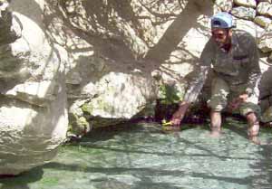
Figure 4. The Obe Shefa (healing) hot spring, Obe Township, 120 km to the
east of Herat city, with a surface temperature of 52ºC and a very hot ground in
a granitic contact zone.
The hot springs in the Kalu and Ghorband valleys, as well as Khwaja Qeech,
and Ghorghuri hot springs in central Afghanistan are examples from the central
portions of the Harirud-Badakhshan geothermal field. Generally, these waters
with chloride-bicarbonate-sodium or chloride-sodium compositions are having high
concentrations of elements such as Ge, Be, B, Fe, Ag, Zn, Pb, Ba, Li, Rb, Sr,
and Sc (Kurenoe and Belianin, 1969).
High mineralisations in these thermal waters could be attributed to the
higher amounts of CO2 in the metamorphic hydro-geochemical
environment, which facilitates the release of geochemical elements from the
surrounding country rocks into the solution. Of these springs, those in the Kalu
Valley (Figure 5), which is located 20 km to the east of the Bamiyan township,
have promising potentials for balneological applications and tourist attraction,
as well as the development of a small scale geothermal power plant, probably in
the range of up to 10MW, in the immediate future.
In the eastern extensions of this field, in the Andarab-Panjshir region, as
well as in the Badakhshan and the Pamirs, fewer hydrothermal manifestations are
exposed on the surface. These are mainly of the nitrogen-bearing category, e.g.,
the Qala-e Saraab hot springs in Andarab, and Bobe-Tangi and Sarghaliyan hot
springs in the Wakhan and Badakhshan regions, respectively. Compared to their
more westerly counterparts, these having lower concentrations of geochemical
elements. The Bobe-Tangi and Sarghaliyan also contains some amounts of hydrogen
sulfide in their solutions.
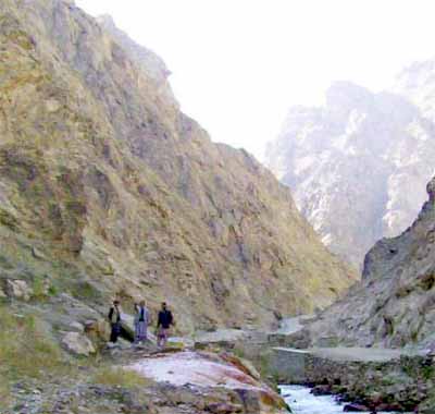
Figure 5. Southerly view of the Kalu Valley, 20 km to the east of Bamiyan
Township, with may hot spring manifestations, seen here to the left of the Kalu
River.
4.2.2. The Helmand-Arghandab Geothermal Field:
With mainly CO2 and nitrogen-bearing waters, hydrothermal
activities in this geothermal field are associated with the Helmand-Arghandab
granitoid massifs, connecting to the main geothermal axis through southern
extensions of the fault and fracture systems of central Afghanistan. The
deep-seated Chaman-Moqor fault system, and other groups of secondary faults are
the main structural factors in the formation of this geothermal field, which
covers regions such as Helmand, Moqor, and Tirin-Azhdar in south-central
Afghanistan. The latter having thermal springs with the highest water discharges
in the country. Hydrothermal activity here is mostly characterized by categories
of CO2 and nitrogen-bearing springs, which are normally rich in
silicic acid and many solid minerals as micro-components in the solution.
The main areas of activity in this field are those in the vicinities of the
Chaman-Moqor fault system, which is characterized with many
CO2-bearing thermal springs, rich in alkali and rare earth elements.
In the Helmand fault and fractures system, thermal springs are more similar in
their hydrogeochemical composition to those of the Panjao-Bande Amir hot
springs. Geothermal activity in the vicinity of Helmand-Arghandab granitoid
complex in the Tirin-Aajar area is very typical, in the sense that in
southeasterly direction from the main Helmand fault system, the content of
CO2 decreases as the amount of nitrogen and nitric acid
increases.
4.2.3. The Farahrud Geothermal Field:
This field is located in the Farahrud structural depression to the southwest
of the main geothermal axis in southwestern Afghanistan. Geothermal activity in
the form of hydrothermal springs in this field is associated with Pasaband
deep-seated fault and fracture system. In its southwestern extension, it joins
the nitrogen-bearing hydrothermal system of the Helmand-Arghandab geothermal
field. Bicarbonate-calcium nitrogen-bearing thermal waters rich in silica and
void of CO2 are the norm in this geothermal field.
4.2.4. The Baluchistan Geothermal Field:
To the extreme southwestern corner of Afghanistan lies the volcanic terrain
of Chagai-e in Baluchistan, with lots of hydrothermal activity, mainly of brine
nature, rich in CO2 and calcium. Two types of brine waters are
typical for this field: thermal chloride-sodium rich pressured waters with a pH
level of 6-6.6 that release high amounts of gases from the solution at the
surface, leaving behind travertine and halite deposits; and chloride thermal
waters with little or no gas in the solution, having a pH level of 7.8-8. These
hydrothermal activities are suggested to be associated with carbonatitic
post-volcanic processes in this region, resulting in the deposits of beautiful
onyx marbles.
5. Economics and the Applications of Geothermal Energy
5.1. Geothermal Energy is a Viable Option:
Presently, Afghanistan is very dependent on foreign energy sources, importing
most of its energy needs from Iran or Turkmenistan in the forms of electricity,
natural gas, and petroleum products. The most important economic aspect of
geothermal energy use is that it's homegrown. Utilization of indigenous
resources reduces the dependency of the country on foreign energy sources, which
in turn will decrease the annual trade deficit that translates into more jobs
and a fairly healthy economy. At the same time, a vital measure of national
security is gained when the country control its own energy supplies.
Although fossil fuels are draining the foreign exchange reserves of the
country and are very costly for Afghanistan, their consumption is growing and
will continue to grow in the foreseeable future by necessity, causing further
stress to the overall economy and to the very fragile environment of the
country. On the other hand, geothermal energy is a clean, renewable and
sustainable energy source, available for Afghanistan to exploit on its own turf,
either directly as a heat source or to generate electric power.
Currently, over 60 countries around the world use the geothermal energy as a
source for power generation or in direct use applications (Table 1).
Table 1: Regional geothermal power plants in operation in 2000 (IGA,
2001)
Region		Electric Power	  Direct Use .
		MWe	GWh/y	MWt	GWh/y
Africa		53.5	396	121	492
Americas	3,390	23,342	5,954	7,266
Asia		3,095	17,509	5,150	22,532
Europe		998	5,745	5,630	19,090
Oceania		437	2,269	318	2,049
Total		7,974	49,261	17,174	51,428
Geothermal energy is independent of weather, contrary to solar, wind, or
hydro applications, with an inherent storage capability. The relatively high
share of geothermal energy as a source for electricity production, compared to
solar or wind, reflects the reliability of geothermal plants, which commonly
have a capacity factor of 70-90% (IGA, 2001), i.e., the average geothermal power
plant is available 90% of the time.
Of the total electricity production of 2826 TWh in 1998 from renewable energy
sources in the world, 92% came from hydropower, 5.5% from biomass, 1.6% from
geothermal and 0.6% from wind. Solar electricity contributed only 0.05% and
tidal 0.02% of the total (WEA, 2000). Comparison of the four "new" renewable
energy sources (Table 2) shows that 70% of the electricity generated by these
four comes from geothermal, while it holds only 42% of the total installed
capacity. Among these, wind energy contributes 27% of the electricity, whole
having 52% of the installed capacity.
Table 2. Electricity from four renewable energy resources in 1998 (WEA,
2000)
		Operating	Production
		capacity    	per year    .
		GWe	%	TWh/y	%
Geothermal	8	41.4	46	69.6
Wind		10	52.1	18	27.2
Solar		0.9	4.7	1.5	2.3
Tidal		0.3	1.5	0.6	0.9
Total		19.2	100	66.1	100
Heat production from renewable energy sources deemed to be commercially
competitive with conventional energy sources. Of these, biomass constitutes 93%
of the total direct heat production from renewable energy sources, geothermal
5%, and solar heating 2%.
5.2. Geothermal Energy is Efficient and Cost Effective:
Research sponsored by governments and companies continues to improve
geothermal technology. Despite higher initial cost, the life-cycle cost of
geothermal energy utilization is reasonably low. When the environmental benefits
are factored in, the case for increased geothermal use among other renewables is
compelling (IGA, 2001).
Current geothermal power plant installation costs are in the range 1000-3000
USD/kW, which is equivalent to the production cost of 2.2 to 5.4 US cents/kWh.
The investment cost of a conventional direct heat district heating system is in
the range 400-1400 USD/kW. This corresponds to a production cost of some 0.8-3
US cents/kWh (IGA, 2001). A comparison of the renewable energy sources by UN
World Energy Assessment Report (WEA, 2000) shows that the current electrical
energy cost is 2-10 US cents/kWh for geothermal and hydro, 5-13 US cents/kWh for
wind, 5-15 US cents/kWh for biomass, 25-125 US cents/kWh for solar photovoltaic
and 12-18 US cents/kWh for solar thermal electricity.
The current cost of direct heat from biomass is 1-5 US cents/kWh, geothermal
0.5-5 US cents/kWh, and solar heating 3-20 US cents/kWh (Fridleifsson, 2000).
These figures indicate that currently electricity produced by geothermal power
plants is becoming cost-competitive with other forms of energy
It is apparent that the cost of geothermal electrical energy is compatible
with the costs that Afghanistan is paying for electricity purchased for a period
of ten years from Iran (2.8 US cents/kWh) and Turkmenistan (2.0 US cents/kWh).
These prices are on top of the installation expenses of 16 million USD for 132km
of high voltage lines and a transfer substation with a capacity of 50MWe from
Iran; and 6.3 million USD for 120 km transfer lines and 2.3 million USD transfer
substation with a capacity of 30MWe from Turkmenistan, respectively (DEPCH,
2003). At this point, though these projects seem to be great deals, and the
immediate cost to Afghanistan is much lower than if it had developed a
hydroelectric power station with the same capacity, or few small-scale
geothermal power plants. But, if we factor in the price that would be paid out
of the country's reserves for the consumption of the power supply, continuously
for the lifetime of these projects, the lost of job opportunities for Afghans,
the underdeveloped renewable energy potentials of the country, environmental,
strategic, as well as national security issues, then, they are not such sweet
deals at all.
Though, such cross-border projects may be viable options for certain regions
of Afghanistan, they may not be feasible options for supplying energy to remote
communities, such as the ones in central and northeastern Afghanistan. In the
view of the authors, having numerous small scale multipurpose hydroelectric and
geothermal power plants in the range of 5-20 MWe (megawatt of electric energy)
can be extremely useful for Afghanistan. Such plants could potentially provide
significant power for isolated populations, mining operations, and other local
small industries, while creating thousands of permanent jobs for people who are
in dire need of it.
5.3. Geothermal Energy For Electricity Production:
Electricity is in serious shortage all over Afghanistan, in particular in the
remote rural areas. This is severely affecting the overall reconstruction
efforts and economic development of the country. Reconstruction of industry,
agriculture and food processing is not possible without a sustainable supply of
electricity. Moreover, increasing forest cutting and use of animal waste is
progressively damaging the severely degraded natural environment of the
count
Potential geothermal energy reserves in Afghanistan could provide part of the
electricity needs required to satisfy the demand. Electrical power production is
the most profitable use of geothermal energy, and worldwide has grown the most,
comparing to other geothermal applications. Electricity is produced with
geothermal steam in 21 countries, with the USA being the top producer in 1999,
producing 2228 MWe. In the Philippines, about 22% of the electricity is
generated with geothermal steam. Other countries presently generating 10-20% of
their electricity with geothermal energy are Costa Rica, El Salvador, Iceland
and Nicaragua (Huttrer, 2001). Currently many developing countries such as
Turkey, Kenya, Taiwan, Chile, and Tibet in China are also developing their
geothermal fields.
To generate electricity from geothermal hot water, two prerequisites are
required to be fulfilled: adequate technology, and an abundant high-temperature
water or steam. At present, efficient and durable technology is readily
available to Afghanistan to produce low-cost electricity from its geothermal
resources. At the meantime, the tectonic structure of Afghanistan suggests the
presence of vast hot water circulation systems underground. But only under
certain conditions of depth, temperature, and chemistry does it pay to drill
into these systems, conditions that require further explorations to be
undertaken.
In planning for a geothermal electrical plant, the following questions has to
be answered: how much steam can be exploited form the field, how long will the
steam last, and where should the drilling take place? When the hot-water wells
are of low temperature, either a flash steam or a binary cycle system would be
installed. These systems are used where the geothermal fluids are just barely
mineralized. Additionally, the costs of these systems are higher than the simple
steam cyclone and turbine system. However, low temperature water can be used
very economically for non-electrical purposes.
In water-dominated geothermal systems, such as the one in Afghanistan, water
comes into the wells from the reservoir, and the pressure decreases as the water
moves toward the surface, allowing the water to boil. Only part of the water
boils to steam, and a separator is installed between the wells and the power
plant to separate the steam and water. The steam goes into the turbine, and the
low temperature water is then circulated through heat exchangers to heat a
secondary liquid, usually an organic compound such as isobutene, with a low
temperature of boiling. The resulting organic vapor then drives another type of
turbine, called a binary power system. The cooler water then could be used for
direct applications and at the end reinjected back into the reservoir to sustain
the geothermal hydraulic system.
In a flash system, where the steam is the dominant phase, the hot geothermal
fluid is piped up to a separator. As soon as the pressure is released, some of
this fluid flashes into steam that rushes off to turn a turbine that spins a
generator. The spent steam is then chilled in a condenser and changed to water
to be pumped back into the ground. However, in a binary system, a heat exchange
method is used. In this system, heat from the geothermal fluid is transferred to
another liquid, a refrigerant such as freon or isobutane that vaporizes and
turns into a highly pressurized gas that flows up a pipe leading to the turbine.
The vaporized refrigerant is then recycled back into the system to continue its
work.
5.4. Geothermal Energy For Direct Uses:
Direct-use geothermal technologies use naturally hot geothermal water for
commercial applications. Afghans know the medicinal and healing properties of
hot water springs, especially its therapeutic power for skin conditions and
rheumatic arthritis. Medicinal bathing or balneology is an important sector to
be considered for modern developments of some of the well-know healing hot
springs of the country. This has the potential to contribute to the improvement
of life standard and the overall well being of the people of Afghanistan, while
creating hundreds of new and permanent jobs.
Afghanistan needs to preserve some of its current available geothermal
resources in their natural state and use them only for recreation and tourism
industry. Thus, not all of the resources currently known may be made available
for development. However, shallow resources suitable for heat pumps are
available and accessible anywhere in the country. Geothermal heat pumps (GHP),
which can be used almost anywhere, use the constant temperature of the top 15-18
meters of Earth's surface to heat buildings in the winter and cool them in the
summer. This mode of using geothermal energy has enjoyed the largest growth rate
in recent years all over the world (IGA, 2001).
Geothermal heat pumps can contribute significantly to improving energy
utilization efficiency and are developing considerable momentum. If installation
of GHPs is combined with the construction of the foundations of new buildings,
its initial capital cost significantly decreases, as successfully demonstrated
in the construction of GHP loops that have been incorporated in the foundation
piles of the new International Airport Building in Zurich (IGA, 2001). In GHP
applications, USA leads the way with approximately 400,000 GHP units (about 4800
MW of heat energy) and energy production of 3300 GWh/y in 1999 (Lund and Boyd,
2000) followed by Switzerland, which is traditionally not known for hot springs
or geysers. The energy extracted out of the ground with heat pumps in
Switzerland amounts to 434 GWh/y, with an annual growth rate of 12% (Rybach, et
al., 2000). It is suggested that any major construction project in Afghanistan,
particularly the new international airport south of the Kabul City, should
consider incorporating this option in the design of the project.
Other non-electrical applications of geothermal energy can involve a wide
variety of end uses, such as chemical industry, greenhouse industry, food
processing, and fish farming, etc. The technology, reliability, economics, and
environmental acceptability of direct use of geothermal energy have been
demonstrated throughout the world. Currently the main types of direct uses are
bathing/swimming/balneology (42%), space heating (35% including 12% with
geothermal heat pumps (GHPs), greenhouse (9%), fish farming (6%), and industry
(6%) (Lund and Freeston, 2001).
Some economically feasible and useful applications of low-temperature waters
in Afghanistan are suggested to be: hatching and fish farming, greenhouse by
combined space and hotbed heating, mining of placer deposits (with high
feasibility in Badakhshan and Ghazni placer gold deposits), fruit drying and
processing, food processing, fur and intestine processing (a traditional
industry in Afghanistan), refrigeration by ammonia absorption, wool processing,
carpet cleaning, tourist and balneological facilities, district heating, drying
and curing of light aggregate cement slabs, extraction of industrial chemical
salts by evaporation and crystallization, biodegradation, fermentation, mushroom
farming, and other small-scale local industries.
Direct application uses, however, are more site specific for the market, as
steam and hot water is rarely transported long distances from the geothermal
site. The production cost/kWh for direct utilization is highly variable, but
commonly under 2 US cents/kWh, proven so economic for Chinese, that their direct
utilization is expanding at a rate of about 10% per year, mainly in the space
heating, bathing, and fish farming sectors. Other examples of a high growth rate
in the direct use of geothermal are found in developing countries such as Turkey
and Tunisia. In the latter, for example, geothermally heated greenhouses have
expanded from 10,000 m2 in 1990 to 955,000 m2 in 1999, with the main products in
the greenhouses being tomatoes and melons for export to Europe, creating
thousands of new jobs in this oasis (Fridleifsson, 2000). Turkey, while
developing its geothermal resources for electricity production, is very focused
on the recreational and other direct applications of this natural resource.
6. Environmental Impacts of Geothermal Energy:
Increasing interest in controlling atmospheric pollution and the spreading
concern about global warming provide a framework for a continuing strong market
for geothermal electrical generation and heat energy extraction. Geothermal
development will serve the growing need for energy sources with low atmospheric
emissions and proven environmental safety. Among all renewables, the geothermal
energy currently produces the third most energy, after hydroelectricity and
biomass. This source of energy does not require fuel-burning to produce heat or
electricity, thus, with its proven technology and abundant resources, can make a
significant contribution towards reducing the emission of greenhouse gases.
Geothermal fluids contain minerals leached from the reservoir structure, as
well as a variable quantity of gases, mainly nitrogen, carbon dioxide and small
amounts of hydrogen sulphide, and ammonia. The amounts depend on the geological
conditions encountered in the different fields. Virtually the entire minerals
content of the fluid and some of the gases are reinjected back into the
reservoir. Only an inconsiderable amount of noncondensable gas is released into
the environment.
The industrial exploitation of a geothermal system is based on the heat
mining from the rocks by using the geothermal fluids as vectors, without any
specific process of CO2 generation. Geothermal power plants emit
little carbon dioxide (fossil-fuel power plants produce 1000 to 2000 times as
much), no nitrogen oxides, no particulate matter, and very low amounts of sulfur
dioxide. Steam and flash plants emit mostly water vapor. Binary power plants run
on a closed-loop system, so no gases are emitted as shown in the following chart
(Figure 6). In this chart, the amount of sulfur dioxide and carbon dioxide
emissions between two fossil-fueled power plants (coal, and oil) and a
geothermal power plant with and without waste gas reinjection into the ground
has been compared.
Figure 6. Comparison of sulfur dioxide and carbon dioxide emissions
between two fossil-fueled power plants, and a geothermal power plant (after
Goddard & Goddard, 1990).
At the same time, land use for geothermal developments is small compared to
land use for other extractive energy sources such as oil, gas, and coal.
Low-temperature geothermal applications are usually no more disturbing of the
environment than regular water wells. Geothermal development projects often
coexist with agricultural land uses, including crop production or grazing.
The Clean Development Mechanism (CDM), promoted by the Kyoto Protocol,
encourages countries such as Afghanistan to invest in their renewable energy
sources, and thus receive credit for the carbon dioxide emissions saved by these
projects to offset the greenhouse gas emission charges in developed countries.
This in turn, fosters financial partnerships that provide access to affordable,
low greenhouse gas emitting commercial energy technologies. By developing its
geothermal resources, Afghanistan will immensely benefits from these
international provisions.
7. Conclusion and Proposals
With the presence of many young magmatic, metamorphic, volcanic, and
collisional tectonic processes in Afghanistan, the potential of geothermal
energy in this country is enormous. Geothermal systems in Afghanistan are not
limited to those with hot springs indicators at the surface. Many systems are
hidden and do not reach the surface. The authors of this report believe that the
most promising prospects for geothermal exploration and characterization of
known and hidden reservoirs are in regions along the Herat-Panjshir and
Chaman-Moqor fault systems.
To develop the potential geothermal prospects for industrial exploitation,
systematic geological, geochemical and geophysical techniques, including fluid
inclusion geothermometry, stable isotope analysis, electrical resistivity
surveys, self-potential (SP) surveys (Ross, et al., 1995), and micro-seismic
analysis are required to locate and delineate shallow producing geothermal
fields. Such a work will pinpoint with much accuracy the particular depths of
hot water reservoirs in particular prospects and set the stage for drilling
exploratory investigations, which would be the final arbitrator for the
evaluation of the reservoirs of these resources. Thus, a major exploration
effort is needed to characterize geothermal reservoirs and build the inventory
of prospect geothermal areas for further development.
Benefits of Geothermal Energy Development to Afghanistan could be summarized
as the following:
- Geothermal resources provide the country with a homegrown source of energy
that can be extracted without burning fossil fuels. Once it is developed, the
country's dependence on foreign energy sources decreases proportionately.
- Use of geothermal energy create the needed permanent full-time jobs for
Afghans, decreases trade deficits, and saves valuable foreign reserves of the
country.
- With very low or no pollutant byproducts, this is one of the most
environmentally clean and friendly sustainable renewable energy source to be
exploited in Afghanistan.
- Afghanistan has the leverage to get financing under the "Clean Development
Mechanism" (CDM), promoted by the "Kyoto Protocol", which encourages developed
countries to invest in renewable energy projects in developing countries.
- Under the (CDM) provisions, the greenhouse gas credits created by
geothermal power plants could be sold on global markets to bring extra cash
revenues.
- Afghanistan has very limited acreage of usable land for industrial
development. The average geothermal power plant requires a total of only 400
square meters of land to produce a gigawatt of power over a period of 30
years, which is incomparable to the huge acreages needed for other power plant
developments.
- Development of geothermal resources in Afghanistan strengthens the
technological, scientific and research capacity of the country through
improved international cooperation.
Considering that geothermal energy is a clean, proven and reliable resource
for supplying the needs of a sustainable society and helping to improve the
environment, and also that the life-cycle costs of geothermal technologies are
competitive with the costs of other forms of energy, especially when
environmental externalities are considered, the authors of this report believe
that strong commitments in research, development, and market deployment are
needed by government of Afghanistan to promote increased utilization of this
natural resource.
It is upon the government of Afghanistan to make strong commitments to
promote the developing of the geothermal resources of the country for the
benefit of its own citizens, humanity and the global environment. A thorough
assessment of the country's geothermal resource potential for use in electrical
power generation, district heating, cooling of homes and buildings, food
processing, green house industry, fish farming and hatchery, refrigeration,
recreation and tourism, and a myriad of other industries has to be undertaken.
To facilitate the accomplishment of these goals, policies and regulations that
promote investment in development of geothermal resources has to be worked
out.
It is suggested that the United Nations, World Bank, Asian Developing Bank,
and other interested global institutions should include strong geothermal energy
components in their developing programs in Afghanistan, and encourage geothermal
industries and agencies worldwide to help in the development of geothermal
resources of this country as a component of the international cooperation in the
rebuilding of Afghanistan.
There is no reason that at the beginning of the 21st century, the development
of geothermal energy that will last a long time and is clean, abundant, and
economically feasible, is not pursued in Afghanistan. The country has the
potential of rapidly developing its geothermal resources for direct uses such as
geothermal tourist and balneological networks, greenhouse industry, food
processing, fruits drying and processing, wool processing, carpet cleaning, and
chemical applications. Though, development of geothermal resources for electric
generation may not be a priority at this point, nonetheless, a large electric
power generation potential from geothermal resources is readily available for
Afghanistan. Use of geothermal energy in Afghanistan for electric and
non-electric applications is feasible and realistic.
Acknowledgements:
The fund for this work is provided by the Center on International
Cooperation, New York University, by a grant from the Open Society Institute.
The Afghanistan Center for Policy and Development Studies has facilitated and
supported this research project in Afghanistan. The Kabul Polytechnic Institute
and the Herat University in Afghanistan have provided local support and research
facilities. The Department of Geological Survey of the Ministry of Mines and
Industry of Afghanistan has kindly provided permission to access the pertaining
archive information on the previous work. We are grateful to the AIMS office of
the UNDP Kabul, for generously providing the topographical maps of Central and
Western Afghanistan to this project.
This work would have not been possible without the support of Dr. Barnett
Rubin, Director of CIC, New York University, USA. We would like to express our
gratitude for efficient help and kindness of Dr. Omar Zakhilwal, senior advisor
to the Ministry of Rural Rehabilitation and Development of Afghanistan. We are
indebted to Prof. Edward Friedman of the St. Stevens Institute of Technology,
New Jersey, USA, for his review of the draft of this report and very useful
comments. We are grateful to Prof. Najibullah Safdari for his kindly review of
the draft of this report and comments. We are also indebted to many colleagues
and locals in Kabul, Bamiyan, Parwan, and Herat provinces, who have generously
provided us with guidance, logistical support and encouragement throughout this
work.
Bibliography:
- Akhi, M. Wazir (2001): The Services of Abdullah Khan Malekyar in Herat.
Hand scripted biography, in Persian. London, Ontario, 605pp.
- Beck, R. A., et al. (1995): Stratigraphic evidence for an early collision
between northwest India and Asia. Nature, 373, pp.55-58.
- Belianin, V. I., Sobolev, B. I., and Ataei, G. (1970): The Report of
Studies on Mineral Waters of Afghanistan from 1969-1970. Geo. Surv. Afgh.,
Kabul.
- Bogie, I., and Lawless, J. (2000): Application of mineral deposit concepts
to geothermal exploration. Proceedings of the World Geothermal Congress 2000,
Japan, May 28 - June 10, pp.1003-1006.
- CSO, (2003): Central Statistics Office of Afghanistan. Official data
presented during the Workshop on National Human Development Report of
Afghanistan, 8-9 December 2003, Kabul, Afghanistan.
- Du Shaoping (2000): Exploration, Development and Utilization of Geothermal
Resources in Tibet, in: Proceedings of the World Geothermal Congress 2000,
Japan, pp. 1095-1101.
- Fridleifsson, I.B. (2000): Geothermal Energy for the Benefit of the
People. Submitted to Renewableand Sustainable Energy Reviews, Elsevier, UK,
14pp.
- Goddard, and Goddard (1990): Proceedings of the International Symposium on
Geothermal Energy, Geothermal Resource Council Transactions, No.14,
pp.643-649.
- Goldin, Augusta R. (1981): Geothermal Energy, A Hot Prospect. HBJ
Publishers, NY, 128pp.
- DEPCH (2003): Corresponding documents of the Department of Electrical
Power of the City of Herat (DEPCH) in response to inquiries by the University
of Herat, Afghanistan.
- Holt, Ben (1977): Geopressured Resource: A Sleeping Giant. Geothermal
Energy, Vol.5, No.11, pp.30-32.
- Huttrer, G.W. (2001): The Status of World Geothermal Power Generation
1995-2000. Geothermics, n.30, pp.1-27.
- IEA (1998): International Electricity Consumption Comparison in 1998.
International Energy Agency, Combined State Energy Data Systems 1997.
Available at:
href="http://www.mindfully.org/Energy/Energy-Use-Per-Person11feb01.htm">Californians
Aren't Energy Hogs: Only Rhode Island, New York and Hawaii use less per
person, agency says -- Texas uses most San Francisco Chronicle 11feb01
http://www.sfgate.com/cgi-bin/article.cgi?f=/chronicle/archive/2001/02/11/MN182761.DTL
- IGA (2001): Contribution of Geothermal Energy to the Sustainable
Development. Report of the International Geothermal Association (IGA)
submitted to the 9th Conference on Sustainable Development, Pisa, Italy, 2001,
13pp.
- Kurenoe, V.V., and Belianin, V.I. (1969): Mineral waters of Afghanistan,
Dept. Geol. Surv., Kabul, Afghanistan.
- Lund, J.W. and Boyd, T.L. (2000): Geothermal direct-use in the United
States, Update 1995-1999. WGC2000,CD-ROM, p.297-305.
- Lund, J.W. and Freeston, D.H. (2001): World-wide direct uses of geothermal
energy 2000. Geothermics, n.30, pp.29-68.
- Musazai, A. (1994): Research on ultrabasites of Afghanistan and their
industrial mineralization. Research monograph, Kabul Polytechnic Inst.,
Afghanistan, 127pp. (in Persian)
- Nuti, S. (1991): Isotope techniques in geothermal studies. In: D´Amore
(coordinator), Applications of geochemistry in geothermal reservoir
development. UNITAR/UNDP publication, Rome, 215-251.
- Nyrop, Richard F., and Seekins, Donald M. (1986): Afghanistan: A Country
Study. Foreign Area Studies, the American University, pp.170-171.
- Ross, H. P., Blackett, R. E., and Witcher, J. C. (1995): The
Self-Potential method: Cost-effective exploration for moderate-temperature
geothermal resources, Proceedings,World Geothermal Congress, Florence, Italy,
Vol. 1, pp.645-648.
- Rybach, L., Brunner, M., and Gorhan, H. (2000): Swiss geothermal energy
update 1995-2000. WGC2000,CD-ROM, pp.413-426.
- Saba, D.S., and Avasia, R. K. (1995a): Structural patterns and economic
prospects of Hidukush. Abstract Volume of the "10th Himalaya-Karakoram-Tibet
Workshop", 4-8 April, Ascona, Switzerland, (Eds): David A. Spencer,
Jean-Pierre Burg and Cinzia Spencer-Cervato, ETH-Zurich, Switzerland, 4pp.
- Saba, D.S., and R. K. Avasia (1995b): Evolution and uplift of Hindukush -
A precursor to the Himalayan Orogeny. Abstract Volume of the "10th
Himalaya-Karakoram-Tibet Workshop", 4-8 April 1995, Ascona, Switzerland,
(Eds): David A. Spencer, Jean-Pierre Burg and Cinzia Spencer-Cervato,
ETH-Zurich, Switzerland, 3pp.
- Shareq, A., Chemeriov, V. M., and Dronov, V. I. (1980): Goelogy and
Mineral Resources of Afghanistan, Book II: Geology. Nedra, Moscow, 535pp. (in
Russian)
- Tapponnier, P., Mattuauer, M., Proust, F. and Cassaigneau, C. (1981).
Mesozoic ophiolites, structure and large-scale tectonic movements in
Afghanistan, Earth and Planetary Science Letters, 52, pp.355-371.
- Tester, J. W., and Smith, M.C. (1978/79): Energy Extraction
Characteristics of Hot Dry Rock Geothermal Systems. Geothermal World
Directory, pp.340-347.
- UNEP (2003): Afghanistan: Post-Conflict Environmental Assessment, UNEP,
Geneva, 175pp.
- WEA (2000): World Energy Assessment Report. Prepared by the UNDP, UN-DESA
and the World Energy Council. United Nations, New York.
- WEC (1993). Energy for Tomorrows World. World Energy Council, St.
Martins Press, USA, pp. 320.
- WGC (2000): Preamble of the Declaration of the World Geothermal Congress
2000, Beppu/Morioka, Japan.
******
Appendix 1.
Glossary:
Advection: Transport or transfer of heat, by means of the movement
of a media such as water in the system.
Andesite: A volcanic rock composed essentially of the
mineral andesine and one or more mafic mineral constituents, such as pyroxene,
hornblende, or biotite, or all three in various proportions.
Aquifer: Water-bearing stratum of permeable sand, rock, or
gravel.
Batholith: The largest and massive body of intrusive rocks,
solidified as coarse crystalline rock in the deep horizons of the crust.
Binary-cycle plant: A geothermal electricity generating
plant employing a closed-loop heat exchange system in which the heat of the
geothermal fluid (the "primary fluid") is transferred to a lower-boiling-point
fluid (the "secondary" or "working" fluid), which is thereby vaporized and used
to drive a turbine/generator set.
Biomass: Plant material, vegetation, or agricultural wastes
used as an energy source.
Brine: A geothermal solution containing appreciable amounts of
sodium chloride or other salts.
Carbonated: Water containing carbon dioxide gas in
solution, common in volcanic and tectonically active zones. Sometime contain so much gas that if a
little sugar thrown into water, it effervesces like soda
water.
Carbonatitic: Pertaining to
carbonatite, an igneous carbonate rock, which is associated with alkaline
igneous intrusive activity in many localities, produced by a
phase of magmatism that is rich both in soda and lime.
Cenozoic: The latest of the four geological eras, extending
from the close of the Mesozoic era to and including the present, including the
periods called Tertiary and Quaternary in accordance to the US geological
nomenclature.
Condenser: Equipment that condenses turbine exhaust steam into
condensate.
Cretaceous: The third and
latest of the periods of geological time included in the Mesozoic era.
Crust: The hard outer covering, or the exterior portion of the
earth that lies above the Mohorovicic discontinuity.
Dacite: An extrusive igneous rock, in which the principal
minerals are plagioclase, quartz, pyroxene or hornblende or both with minor
amounts of biotite and sanidine.
Direct use: Use of geothermal heat without first converting it
to electricity, such as for space heating and cooling, food preparation,
industrial processes, etc.
District heating: A type of direct use in which a utility
system supplies multiple users with hot water or steam from a central plant or
well field.
Drilling: Boring into the earth to access geothermal
resources, usually with oil and gas drilling equipment that has been modified to
meet geothermal requirements.
Dry hot rock: Dry hot rock. Subsurface geologic formations of
abnormally high heat content that contain little or no
water.
Dry steam: Very hot steam that doesn't occur with
liquid.
Efficiency: The ratio of the useful energy output of a machine
or other energy-converting plant to the energy input.
Endogenic: Pertaining to processes that originate within the
earth, and to rocks, ore deposits, and landforms, which owe their origin to such
processes.
Eurasia: The landmass and a major tectonic plate of the earth, comprising
the continents of Europe and Asia.
Fault: A fracture or fracture zone in the Earth's crust along which
slippage of adjacent earth material has occurred at some time.
Flash steam: Steam produced when the pressure on a geothermal liquid is
reduced. Also called flashing.
Fracture: Breaks in rocks due to intense folding or faulting.
Geology: Study of the planet earth, its composition, structure, natural
processes, and history.
Geochemical: Pertaining to the distribution and circulation of chemical elements in the earths crust, soil,
water and atmosphere.
Geosuture: Large mobile zones between two rigid
plates of the earth crust, normally joining two plates
together such as a suture.
Geothermal: The generation of hot water or steam by hot rocks in the
earths interior. Of or relating to the earth's interior heat.
Geothermal energy: The earth's interior heat made available to man by
extracting it from hot water or rocks.
Geothermal gradient: The rate of temperature increase in the earth as a
function of depth. Temperature increases an average of 1° Fahrenheit for every
75 feet in descent.
Geothermal heat pumps (GHP): Devices that take advantage of
the relatively constant temperature of the earth's interior, using it as a
source and sink of heat for both heating and cooling. When cooling, heat is
extracted from the space and dissipated into the earth; when heating, heat is
extracted from the earth and pumped into the space.
Geyser: A spring that shoots jets of hot water and steam into
the air.
Gondwana: The supercontinent of the southern hemisphere of the
earth, which broke up into India, Australia, Antarctica, Africa, and South
America during the Paleozoic Era.
Granitoid: Pertaining to coarse-grained igneous or
metasomatic rocks, including granite, diorite, syenite, granite porphyry,
diorite porphyry, massive gneiss, migmatite, gabbro, peridotite, hornblendeite,
pyroxenite, and amphibolites.
Greenhouse gases: gases, principally water vapor and carbon
dioxide that trap surface heat, thereby warming the earths atmosphere.
GWh/y: Gigawatt-hour per year of energy. A gigawatt is one
thousand megawatts or a billion watts.
Heat exchanger: A device for transferring thermal energy from
one fluid to another.
Heat flow: Movement of heat from within
the earth to the surface, where it is dissipated into the atmosphere, surface
water, and space by radiation.
Hydrothermal: Underground systems of hot water and/or
steam.
Injection: The process of returning spent geothermal fluids to
the subsurface. Sometimes referred to as reinjection.
Intrusive: any igneous
body that solidifies in place below the surface of the earth.
Juvenile water: Water that is derived from
the interior of the earth and has not previously existed as atmospheric or surface
water.
Kilowatt (kW): A kilowatt or kW is one thousand watts of
energy.
Kilowatt-hour (kWh): The energy represented by 1 kilowatt of
power consumed for a period of 1 hour.
Magma: A molten rock material generated within the earth, from
which, igneous rocks are being formed by cooling.
Magma chamber: A large reservoir in the earths crust occupied by a body
of magma.
Mantle: The earth's inner layer of molten rock, lying beneath the earth's
crust and above the earth's core, composed of dense iron-magnesium-rich
rocks.
Megawatt-hour (MWh): A megawatt-hour is one thousand kilowatts or a
million watts-hour of energy.
MWe: Megawatt of electric energy.
MWt: Megawatt of thermal power.
Mesozoic: One of the grand divisions or eras of geologic time, following
the Paleozoic and succeeded by the Cenozoic era, comprising the Triassic,
Jurassic, an Cretaceous periods.
Metamorphic: Pertaining to rocks, which have formed in the solid state in
response to pronounced metamorphism.
Metamorphism: Changes of temperature, pressure, and chemical environment,
below the shells of weathering and cementation.
Meteoric water: Water that occurs in or is derived from the atmosphere.
Neogene: The later of the two periods into which the Cenozoic era is
divided according to the European nomenclature of geologic time.
Neotectonic: Pertaining to the tectonic activities
that occurred between the end of the Miocene and the present.
Onyx marble: Translucent layered variety of calcite somewhat resembling
true onyx in appearance, usually formed as vein filling or spring and cave
deposits.
Palaeogene: The earlier of the two periods comprised in the Cenozoic era
according to European nomenclature of geologic time.
Period: A division of geologic time longer than an epoch and included in
an era.
Permeability: The capacity of a substance, such as rock, to
transmit a fluid. The degree of permeability depends on the number, size, and
shape of the pores and/or fractures in the rock and their interconnections. It
is measured by the time it takes a fluid of standard viscosity to move a given
distance. The unit of permeability is the Darcy.
Plate: In the theory of plate tectonics, one of the sections
of the earths lithosphere, constantly moving in relation to the other
sections.
Plate tectonics: A theory of global-scale dynamics
involving the movement of many rigid plates of the earth's crust. Tectonic
activity is evident along the margins of the plates where buckling, grinding,
faulting, and volcanism occur as the plates are propelled by the forces of
deep-seated mantle convection currents. Geothermal resources are often
associated with tectonic activity, since it allows groundwater to come in
contact with deep subsurface heat sources.
Pluton: A body of igneous rock formed beneath the
surface of the earth by consolidation of magma.
Precambrian: Of or belonging to the period of geological time
from approx. 3.8 billion years ago to approx. 570 million years ago, often
subdivided into the Archean and Proterozoic eons.
Quaternary: Of or belonging to the geologic time of the second
and last period of the Cenozoic Era,
characterized by the appearance of humans.
Reducing: A system devoid of free oxygen in the solution or
geochemical environment.
Renewable energy source: Renewable describes a property of
the energy resource, which are in one way or another linked to some continuous
energy process in nature. The conditions must be such that the action of
extracting energy from the natural process will not influence the process or
energy circulating in nature.
Reservoir: A natural underground container of liquids, such as water or
steam, or in the petroleum context, oil or gas.
Salinity: A measure of the quantity or concentration of dissolved salts
in water.
Strata: Layered rock formations, also called beds.
Strike-slip fault: Transcurrent fault. A fault in which the net slip is
practically in the direction of the faults strike.
Strike: The course or bearing of the outcrop of an inclined bed or structure on a level surface.
Sustainable energy source: Sustainable describes how the
energy resource is utilized. Sustainable operation of the resource is achieved
by matching the heat extraction rate with the natural recharge rate.
TDS: Total dissolved solids. Used to describe the amount of
solid materials in water.
Tectonics: Pertaining to building or construction of the
structure of the earths crust due to the forces or conditions within that cause
movements of the crust of the earth.
Terrain: A region of the earths surface that is treated as a
physical feature or as a type of environment.
Thermal gradient: The rate of increase or decrease in the
Earth's temperature relative to depth.
Transmission line: Structures and conductors that carry bulk supplies of electrical energy from
power-generating units.
Turbine: A bladed, rotating engine activated by the
reaction or impulse, or both, of a directed current of fluid. In electric power
applications, such as geothermal plants, the turbine is
attached to and
spins a generator to produce electricity.
TWh/y: Terrawatt-hours per year of energy. A terawatt is one
thousand gigawatts or a trillion watts.
Uplift: Elevation of any extensive part of the earths surface
relatively to some other parts.
Volcanism: Pertaining to the phenomena of volcanic eruption,
the explosive or quiet emission of lave, pyroclastic ejecta or volcanic gases at
the earths surface, usually from a volcano.
Watt (W): One watt is a rate for the production or use of
energy, which equals to 1 joule of energy per second. A 100 watt light bulb uses
100 joules of energy every second.
Water-dominated: A geothermal reservoir system in which
subsurface pressures are controlled by liquid water rather than by vapor.
Appendix 2.
List of Surface Geothermal Indications in Afghanistan
(surface temperatures >20ºC): Source Discharge Temp. Geographical
No. (lit/sec) ºC Chemistry Geochemical Environment Location
1 2.0 30-35 Cl, Na Metamorphic, CO2-bearing Kaltaki, Herat
2 0.1 24-26 Cl, Na Metamorphic, CO2-bearing Gashugi, Herat
4 0.1 26-28 HCO3, SO4, Cl, Na, Mg Metamorphic, CO2-bearing Koshke Kohne, Herat
(7g/lit)
7 0.2 22-25 Cl, HCO3, Na, K, Mg, Si, Br, Metamorphic, CO2-bearing Arvich, Herat
F, I (3.4g/lit)
8 3.0 30-35 HCO3, SO4, Ca, Mg, Na, K, Ti, Metamorphic, CO2-bearing Khoja Osman, Herat
V, Cr, Zr, Ga, Be, I, Sr
9 2.0 20-35 Ca, SO4 Metamorphic, CO2-bearing Herat
14 100.0 20-35 Cl, Na Metamorphic, CO2-bearing Bamiyan
18 10.0 24-35 HCO3, Cl, Na, K, Ca, Mg, Al, Metamorphic, CO2-bearing Ghurghuri, Bamiyan
Si, Fe, Ti, Ba, As, V, Ga, Ni, (2.2g/lit)
Co, I, Cu, Pb, Cr
18a 70.0 20-35 HCO3, Na Metamorphic, CO2-bearing Bamiyan
19 10.0 20-35 HCO3, Ca Metamorphic, CO2-bearing Bamiyan
20 2.0 20-35 HCO3, Na Metamorphic, CO2-bearing Bamiyan
25 2.0 20-35 HCO3, Na Metamorphic, CO2-bearing Baghlan
26 0.6 25-27 HCO3, Cl, SO4, Na, K, Ca, Mg, Metamorphic, CO2-bearing Khoja Qeech, Bamiyan
Fe
26a 0.5 20-35 HCO3, Na Metamorphic, CO2-bearing Baghlan
127 15.0 30-32 Cl, SO4, Na Anaerobic, N-bearing Ziarat Garmab, Fara
129 3.0 20-35 HCO3, Na Metamorphic, CO2-bearing Farah
31 1.0 20-35 HCO3, Ca, Na Metamorphic, CO2-bearing Baghlan
32 10.0 20-35 HCO3, Ca, SO4 Metamorphic, CO2-bearing Baghlan
37 0.1 37-39 HCO3, Ca, Mg, SO4 Metamorphic, CO2-bearing Sorkhe Parsa, Kapis
38 0.2 20-35 HCO3, Ca, Na, SO4 Metamorphic, CO2-bearing Kapisa
39-40 0.2 28-32 HCO3, Ca, Na, Mg Metamorphic, CO2-bearing Farenjal, Parwan
41 1.5 20-35 HCO3, Ca, Na, Mg Metamorphic, CO2-bearing Parwan
43 0.1 27-29 Cl, Na Metamorphic, CO2-bearing Namakao, Parwan
47 3.0 28-30 HCO3, Ca, Na Metamorphic, CO2-bearing Sare Mazar, Parwan
55 0.3 29-33 HCO3, Na, K, Ca, Si, Br, F Metamorphic, CO2-bearing Saranmorkhana, Orezgan
(4 g/lit)
56 0.2 20-35 HCO3, Na, Mg Metamorphic, CO2-bearing Bamiyan
59-60 6.0 20-35 HCO3, Ca, Mg, Na Metamorphic, CO2-bearing Wardak
62 0.1 25-28 HCO3, Ca, Mg Metamorphic, CO2-bearing Naray Folad, Maidan
73 0.7 20-35 HCO3, Na, Mg Metamorphic, CO2-bearing Wardak
75 2.5 20-35 HCO3, Na, Mg Metamorphic, CO2-bearing Wardak
77 2.0 22-24 HCO3, Cl, Ca, Mg, Na, K, F, Metamorphic, CO2-bearing Bande Aindjir, Orezgan
Br, Si
89 0.1 20-35 HCO3, Ca Metamorphic, CO2-bearing Safed Koh, Herat
97 0.1 >35 Cl, Na, Li, Rb, Cs, B Metamorphic (CO2, >2g/lit) NmkShordg, Helmand
102 4.0 42-52 HCO3, Cl, Mg, Ca, Na, K, AL, Reducing, N-bearing Obe, Herat
Be, Ge, Sn, I, Yb, Ti, Si
103-105 0.9-10 45-55 Cl, HCO3, Na, K, Ca, Si, W, Reducing, N-bearing Sarab, Baghlan
Mo, Ge, Sn, Li, Zn, Cu
106 3.0 20-35 H2S, HCO3, Ca, Cl Reducing Badakhshan
107 ? 20-35 HCO3, Ca, Mg Reducing Wakhan, Badakhshan
108 ? >35 HCO3, Ca, Mg Reducing Wakhan, Badakhshan
109 ? >35 HCO3, Ca, Mg Reducing Wakhan, Badakhshan
110 4.0 20-35 HCO3, Ca Metamorphic, CO2-bearing Wardak
111 0.5 >35 HCO3, Ca, Mg Reducing Ghazni
112 0.2 45-50 HCO3, SO4, Na, K Reducing, N-bearing Charsadkhana, Ghazni
113 50.0 20-35 HCO3, Ca, Mg Reducing Orezgan
114 60.0 20-35 HCO3, Ca, Mg Reducing Orezgan
115 2.5 >35 HCO3, Ca, Mg Reducing Orezgan
116 4.0 >35 HCO3, Ca, SO4 Reducing Orezgan
117 5.5 >35 Cl, HCO3, Ca, Mg Reducing Ghazni
119 3.5 20-35 HCO3, Ca, Mg Reducing Ghazni
120 ? 20-35 HCO3, Ca, Mg Reducing Kandahar
121 10.0 >35 SO4, Mg Reducing Kandahar
122 1.5 20-35 HCO3, Ca, Mg Reducing Kandahar
123 7.0 42-45 Cl, HCO3, SO4, Na, K, Ca, Si, Reducing, N-bearing Wakhad, Helmand
Ti, Cu, Sr
124 25.0 >35 SO4, HCO3, Ca Reducing Helmand
125 3.0 38-40 HCO3, SO4, Ca, Mg, Na, K, Si, Reducing, N-bearing Garmab Kajaki, Helmand
Ti, CU, Sr
126 11.0 20-35 HCO3, Ca, Mg Reducing, N-bearing Garmak, Kandahar
128 15.0 20-35 SO4, Cl, Na Reducing Farah
130 3.0 20-35 Cl, Mg Reducing Farah
131 10.0 30-35 SO4, Cl, HCO3, Na, K, Ca, Mg Reducing, N-bearing Pole Khumri, Baghlan
133 3.0 34-36 Cl, SO4, Na, Ca, Si, Br, F Reducing, N-bearing Cheshma Shefa, Balkh
134 2.3 42-45 Cl, SO4, Na, K, Si, F, Br Reducing, N-bearing Abe Garm, Herat
138 5.6 35-38 H2S, Cl, Na, Ca, Mg Reducing, H2S-bearing Drill hole No.1, Jozja
140 25.0 51-55 H2S, Cl, SO4, HCO3, Ca, Mg, Reducing, H2S-bearing Chah Ganj, Balkh
Na, K, Br, F, As, Ge, Be, LI,
Zn, Y, B, Ni
144 100.0 20-35 H2S, HCO3, Ca Reducing, H2S-bearing Jozjan
148 3.0 22-24 HCO3, Ca, Si, Mn, Sr, V, Zr, Metamorphic, CO2-bearing Jare Masjid, Ghor
Cu, Ga, Ti, Li, Ba, Cr, F (2.4 g/lit)
150 0.3 21-24 Cl, SO4, Na, K, Ca, Fe, Si, Oxidizing in sulfides Chashme Namak,
AL, Cu, Sr oxidation zones Farah
153 1.5 20-35 SO4, Ca, Mg Oxidizing in sulfides Herat
oxidation zones
180 4.0 >35 HCO3, Ca, Mg Reducing Konduz
181 0.01 20-35 Cl, Ca Oxidizing in sulfides Torghondi, Herat
oxidation zones
182 0.01 20-35 HCO3, Ca, Mg Oxidizing in sulfides Torghondi, Herat
oxidation zones
200 1.5 20-35 HCO3, Ca, Mg Metamorphic, CO2-bearing Baghlan
202 ? 20-35 HCO3, Ca, Mg Metamorphic, CO2-bearing Loghar
source: http://www.cic.nyu.edu/pdf/Geothermal.pdf
11mar04
|  |
|
|